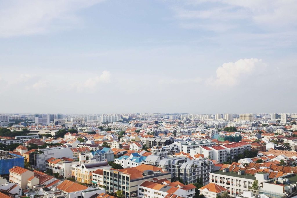
More and more people are using commercial drones for 3D mapping.
Drones equipped with advanced sensors and cameras are capturing data from the sky, offering a wealth of opportunities beyond traditional surveying methods.
These drones can swiftly and accurately document all objects within their field of view, creating datasets that can be stitched together into highly precise 3D models.
Using photogrammetry software, professionals can then transform raw images into comprehensive 3D models that can be easily accessed and analyzed.
These models are now being used across industries like urban planning, telecommunications, and infrastructure management.
However, creating high-quality 3D models requires more than just a good drone. Proper planning, execution, and post-processing play crucial roles.
In this article, we’ll walk you through everything you need to know about 3D drone mapping and modeling, including what a drone 3D model is, which drones are best suited for mapping, and how to create a 3D model from drone images.
Let’s jump right in!
Aerial photogrammetry using drones brings numerous advantages, regardless of the application.
First, drones can easily capture data in areas that are hard or dangerous for surveyors to access, such as regions prone to landslides, conflict zones, rugged terrains, and extreme weather conditions. This significantly reduces the risk of injury for the crew.
Second, equipped with high-resolution cameras, drones can capture sharp and detailed images. When RTK/PPK is enabled, the drone provides highly accurate survey results.
Third, drones drastically cut down the time spent on field surveys. Photogrammetry with drones is five times faster than traditional terrestrial methods and doesn’t require the placement of many GCPs. This allows you to deliver your survey results more quickly.
Finally, drones offer a significant cost reduction compared to the high expenses associated with hiring helicopters or cranes. They are easy to operate, cost a fraction of manned aircraft, and eliminate massive fuel and labor costs.
Are you searching for the best drone for 3D mapping? Not all drones are built for this task. Here, we’ll show you some of the best drones you can purchase for 3D modeling.
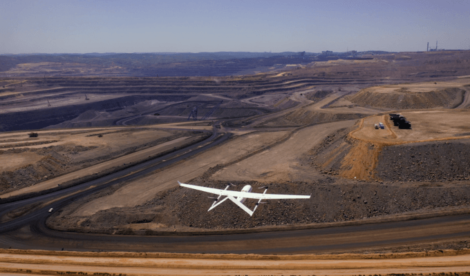
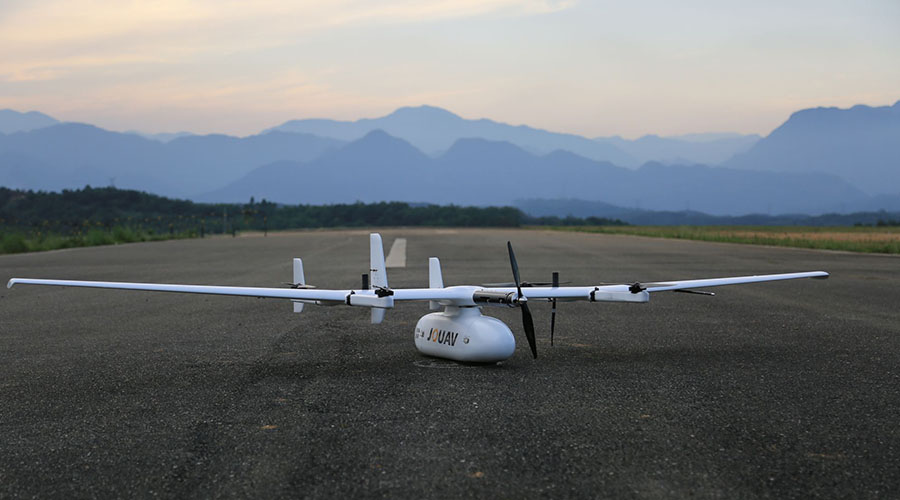
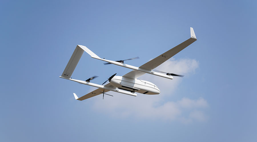
The JOUAV CW-15 is a vertical take-off and landing (VTOL) fixed-wing drone specifically designed for 3D mapping. It boasts a flight time of up to 180 minutes and a cruising speed of 61 km/h, making it ideal for mapping tasks since it can cover a vast area in a short time. With a range of up to 50 km, the CW-15 ensures you won’t lose signal coverage while mapping large areas.
The CW-15 can carry payloads of up to 3 kg, allowing it to carry either a 155 MP five-lens oblique camera for 3D surveys, a 50 MP medium-format camera for capturing orthophotos, or a LiDAR sensor for achieving centimeter-level 3D point clouds.
The CW-15 has a compact design, along with advanced obstacle avoidance features and an intelligent landing system, allowing surveyors to capture complex scenes while protecting the drone from obstacles.
The JOUAV CW-25E is a top-tier drone for 3D modeling that offers impressive flight time, range, speed, and camera quality. Thanks to its powerful motor and large battery, the CW-25E provides 240 minutes of flight time and a cruising speed of 72 km/h on a single charge, giving you ample time to cover large areas or get detailed photos/videos of specific locations.
Equipped with its self-developed PPK and RTK GNSS modules, the CW-25E achieves best-in-class vertical accuracy down to 1 cm while reducing ground control points by more than 80%.
With a range of 50 or 100 km, the CW-25E allows you to explore more of your surroundings and capture stunning images. This camera also records and outputs GPS coordinates and attitude angles at the time of exposure, providing you with the best 3D mapping solution.
The CW-30E is a hybrid electric and gas-powered drone for GIS mapping, providing centimeter-level positioning accuracy. It is specifically designed for mapping and its integrated RTK and PPK modules offer industry-leading positioning performance.
Powered by a four-stroke EFI engine, the CW-30E has a flight time of 600 minutes and a cruising speed of 90 km/h. With a range of 200 km, the CW-30E lets you explore your surroundings extensively without worrying about battery life or losing signal.
Its large cabin space, extensive mechanical and electrical interfaces, and payload capacity of up to 10 kg allow it to carry various mission payloads such as aerial cameras, oblique cameras, LiDAR sensors, and dual thermal cameras. Additionally, the CW-30E can take off and land virtually anywhere—whether on cliffs, in forests, on mountains, or even on moving boats or vehicles.
Why drones are great for aerial photogrammetry?
Best drone for 3D mapping and modeling
JOUAV CW-15: Best Entry-Level Drone for 3D Mapping
JOUAV CW-25E: Best Drone for Photogrammetry
JOUAV CW-30E: Best Drone for GIS Mapping
